Odesa(02:39). Red Alert: aerial threat. Sirens sounding. Take cover now!
Mykolaiv, Mykolayivska Oblast, Odeska Oblast(02:39). Red Alert: aerial threat. Sirens sounding. Take cover now!
Sumska Oblast(01:44). Red Alert: aerial threat. Sirens sounding. Take cover now!
Donetsk Oblast, Kharkiv, Kharkivska Oblast, Kramatorsk(01:40). Red Alert: aerial threat. Sirens sounding. Take cover now!
Poltavska Oblast(01:39). Red Alert: aerial threat. Sirens sounding. Take cover now!
Kryvyi Rih, Zaporizka Oblast, Dnipro, Dnipropetrovska Oblast(01:38). Red Alert: aerial threat. Sirens sounding. Take cover now!
Russian army shelling Zelenodolsk community, south to Kryvyi Rih
 4 year ago
Fires at Black Sea Biosphere reserve in occupied part of Kherson region
 4 year ago
Belarusian military echelon with tanks was filmed on the way to Pinsk
.@PentagonPresSec says most Russian sorties still aren't entering Ukrainian air space. Ukraine still has a viable air force and short- and long-range air defenses
Today, @POTUS will be hosting in the @WhiteHouse Situation Room @SpeakerPelosi and other US lawmakers who recently traveled to Ukraine, @PressSec tells reporters
Ukrainian military liberated Pytomnyk village near Kharkiv
Ukraine's first president Leonid Kravchuk dies at 88
First of the 11 additional Mi-17 helicopters (from Afghanistan) being delivered to Ukraine today, per a senior US defense official
Kharkiv, Kharkivska Oblast(19:32). Red Alert: aerial threat. Sirens sounding. Take cover now!
Kryvyi Rih(19:11). Red Alert: aerial threat. Sirens sounding. Take cover now!
Kirovohradska Oblast, Dnipro, Dnipropetrovska Oblast, Poltavska Oblast(19:11). Red Alert: aerial threat. Sirens sounding. Take cover now!
Kyiv Oblast(18:59). Red Alert: aerial threat. Sirens sounding. Take cover now!
Chernihivska Oblast(18:59). Red Alert: aerial threat. Sirens sounding. Take cover now!
Kyiv(18:56). Red Alert: aerial threat. Sirens sounding. Take cover now!
As a result of coordinated actions of the personnel of the Defense Forces of Ukraine in the Kharkiv region, the settlements of Cherkasy Tyshky, Rusky Tyshky, Rubizhne and Bayrak were liberated - the General Staff of the Armed Forces of Ukraine
The Czech Republic has been officially elected to the UN Human Rights Council, replacing Russia
Ukraine have to stop gas transit through the Sokhranivka station as no access to equipment at occupied territories
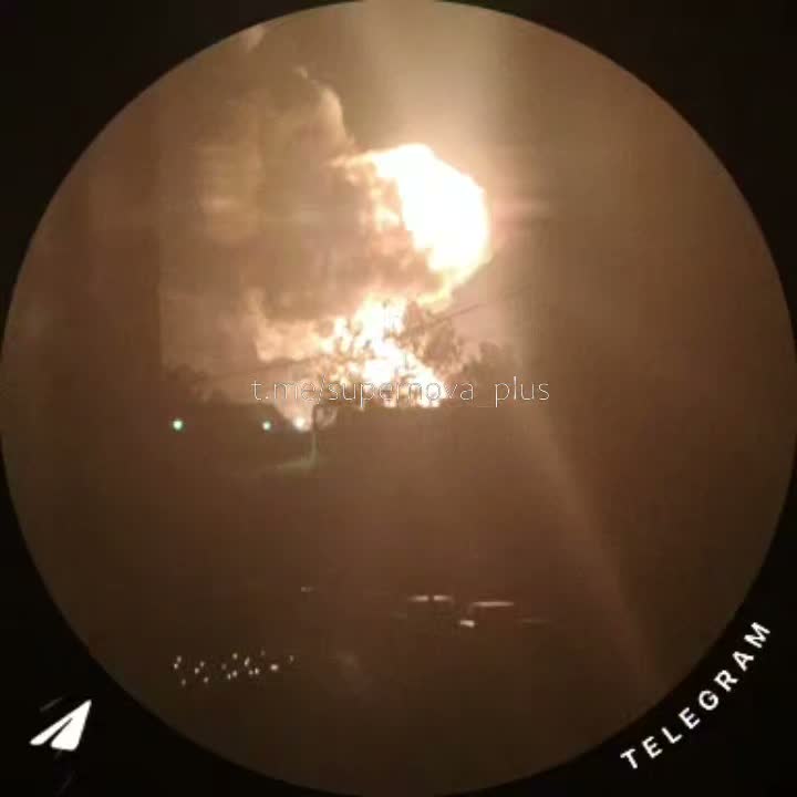
Russian troops shelling Bazaliivka, Lebiyazhe and Korobochkine with mortars
Germany decides to reopen its embassy in Kyiv
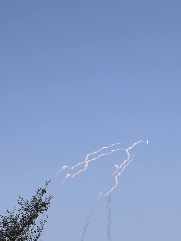
New Russian missile attack against bridge over Dnistrovskyi Lyman
Putin 'likely' to impose martial law in Russia to support war effort: US intelligence chief
Putin determined to take war beyond Donbas to Transnistria: US intelligence chief
Kharkiv, Kharkivska Oblast(16:29). Red Alert: aerial threat. Sirens sounding. Take cover now!
Gas supply halted to Severodonetsk as main gas pipeline damaged in shelling