20 women and children were evacuated today from Azovstal
 4 year ago
Heavy shelling at Lyman
Kirovohradska Oblast, Cherkaska Oblast(22:43). Red Alert: aerial threat. Sirens sounding. Take cover now!
Kryvyi Rih, Donetsk Oblast(22:35). Red Alert: aerial threat. Sirens sounding. Take cover now!
Dnipro, Dnipropetrovska Oblast, Kharkiv, Kharkivska Oblast(22:34). Red Alert: aerial threat. Sirens sounding. Take cover now!
Zaporizka Oblast(21:56). Red Alert: aerial threat. Sirens sounding. Take cover now!
 4 year ago
Confirmed: Kherson in occupied south Ukraine is now in the midst of a near-total internet blackout; real-time network data show the loss of service on multiple providers as one company says incident is "unfortunately not an accident"
Kharkiv, Kharkivska Oblast(20:34). Red Alert: aerial threat. Sirens sounding. Take cover now!
 4 year ago
Russian EMERCOM drone shot down in Donetsk region
As a result of the offensive, the Armed Forces regained control over four settlements in the Kharkiv region - Verkhnya Rohanka, Ruska Lozova, Slobidske and Prilesne - the General Staff of the Armed Forces
The runway of Odesa airport was damaged due to a Russian rocket attack on April 30. Its further use is impossible — Odesa City Council
Prisoners swap today: 7 military and 7 civilians, including pregnant woman released from Russian captivity today - Vice PM of Ukraine
 4 year ago
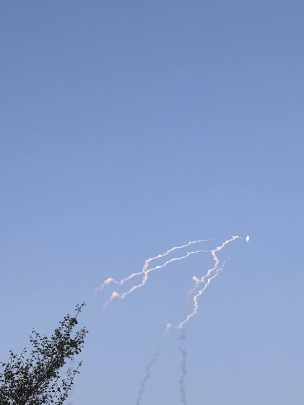
Several explosions near Odesa, possible air defense interceptions
Chernivetska Oblast(18:15). Red Alert: aerial threat. Sirens sounding. Take cover now!
Zakarpattia Oblast(18:13). Red Alert: aerial threat. Sirens sounding. Take cover now!
Ternopil, Ternopilska Oblast, Lviv, Lvivska Oblast(18:11). Red Alert: aerial threat. Sirens sounding. Take cover now!
Rivne, Rivnenska Oblast, Volynska Oblast, Kirovohradska Oblast, Ivano-Frankivsk, Ivano-Frankivska Oblast(18:09). Red Alert: aerial threat. Sirens sounding. Take cover now!
Cherkaska Oblast, Vinnytska Oblast, Zhytomyr, Zhytomyrska Oblast, Khmelnytska Oblast(18:07). Red Alert: aerial threat. Sirens sounding. Take cover now!
Odeska Oblast(18:06). Red Alert: aerial threat. Sirens sounding. Take cover now!
Mykolaiv, Mykolayivska Oblast(18:04). Red Alert: aerial threat. Sirens sounding. Take cover now!
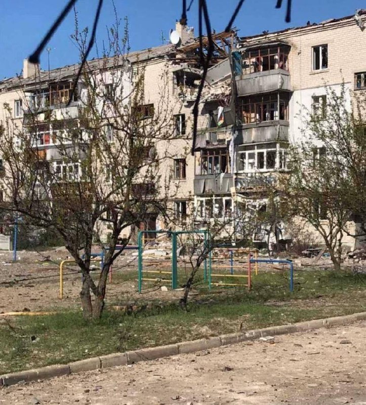
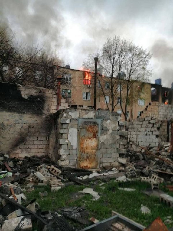
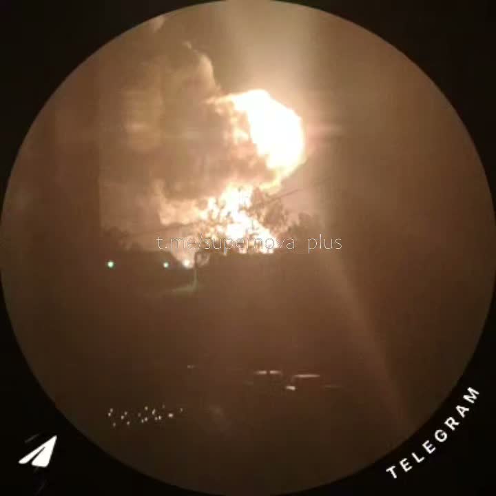
Russian army shelling in Kharkiv now
 4 year ago
This off-nadir satellite image captured by @Maxar's WorldView-3 shows the utter destruction at the Azovstal steel plant in Mariupol. First image shows the overview of the plant, second image slightly more close-up, and closest view of a part of the site is the third image
Kryvyi Rih, Zaporizka Oblast, Donetsk Oblast(15:46). Red Alert: aerial threat. Sirens sounding. Take cover now!
Dnipro, Dnipropetrovska Oblast, Kharkiv(15:45). Red Alert: aerial threat. Sirens sounding. Take cover now!
 4 year ago
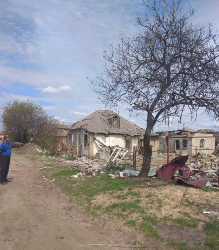
In Dopropillia 7 wounded, including 3 children as result of Russian army shelling
Macron assures the Ukrainian President that France will continue to provide Kyiv with defensive weapons and aid
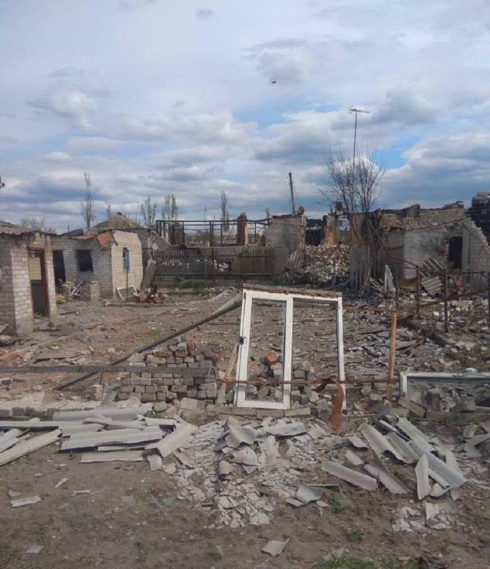
As a result of artillery shelling by the Russian Federation of the Zolochiv community on the night of April 30, a kindergarten, a shop and a house were destroyed.
Shelling continues today in Kharkiv
Kharkiv, Kharkivska Oblast(13:39). Red Alert: aerial threat. Sirens sounding. Take cover now!
Donetsk Oblast, Dnipro, Dnipropetrovska Oblast(13:37). Red Alert: aerial threat. Sirens sounding. Take cover now!